If you are able, please give a donation to help Camp Bethel bridge these challenging months. Thank you!
Color Code: Orange (small metal plates on stakes are bordered in orange)
Estimated time to complete: 2+ hours. Recommended for Mountain Biking, Hiking will take longer
Description: This is our longest adventure that takes you through fields and woods, over hills and valleys, from one end of camp to the other. There are interesting facts and sights to see along the way. Bikers may have to walk over bridges or steep grades depending on their physical fitness levels. Hikers are welcome as well, but it will take much longer. This is a multi-stop adventure. Each stop will give you a nature fact as well as the next set of coordinates to keep you on your way.
Special Equipment: You will need a GPS unit OR a smart phone with google maps or a GPS app. You will also need the first set of coordinates provided below. It is not necessary to have a Camp Bethel Site map for this adventure, but you may want one to keep track of where you went on your adventure! If you have a GPS unit already, Great! You can do this adventure by inputting the coordinate points following the instructions for your device. You do not have to have a GPS unit – Your smart phone with Google Maps will do the same job!
GPS TRAIL 2 COORDINATES:
N37 26.722 W79 47.113
You will find the other coordinates as you go but, if you get lost, click here for the coordinate cheat sheet!
N37 26.722 W79 47.113
You will find the other coordinates as you go but, if you get lost, click here for the coordinate cheat sheet!
Instructions for using google maps on your phone:
(make sure you choose walking) In the search here bar type coordinates given. Use capital N and W, and make sure to leave a space between the degrees and the minutes. Also use a space between the N and W coordinates
How it works:
Your phone/GPS unit is in constant contact with satellites to provide data on where you are, where you are going, and how quickly you are getting there.
The Earth is divided into grids based on Latitude (how for North or South you are from the Equator) and Longitude (How far east and west you are of the Prime Meridian). The United States is ALWAYS North and West for this grid.
The grid points are measured in degrees, with a part of a degree being a minute or second. SO your coordinates will look (or read) like this:
North 37 26.623 ( 37 degrees North and 26.623 minutes)
West 079 47.212 ( 79 degrees West and 47.212 minutes)
North is measured from 0 degrees (the Equator) to 90 degrees both North and South. East and West is measured 180 degrees each way from the Prime Meridian.
Accuracy depends on cloud cover, tree cover, and the number of satellites your unit can reach. This means that you may have to search a bit for the challenge and the next set of coordinates.
Interesting fact: No matter how far you feel like you have gone on your adventure, you are only traveling a part of a minute along this grid, so you will mostly just be changing the last 3 digits of North and West for each point along your way!
What to wear
What to bring
Rules to follow while adventuring at Camp Bethel
- Comfortable, close-toed shoes for walking
- Comfortable clothing that provides protection from the sun/rain
What to bring
- Plenty of water, snacks, maybe even a picnic lunch
- Sunscreen
- Bug/Tick Spray
- A compass (only for the compass adventures) – your smart phone has a compass already installed!
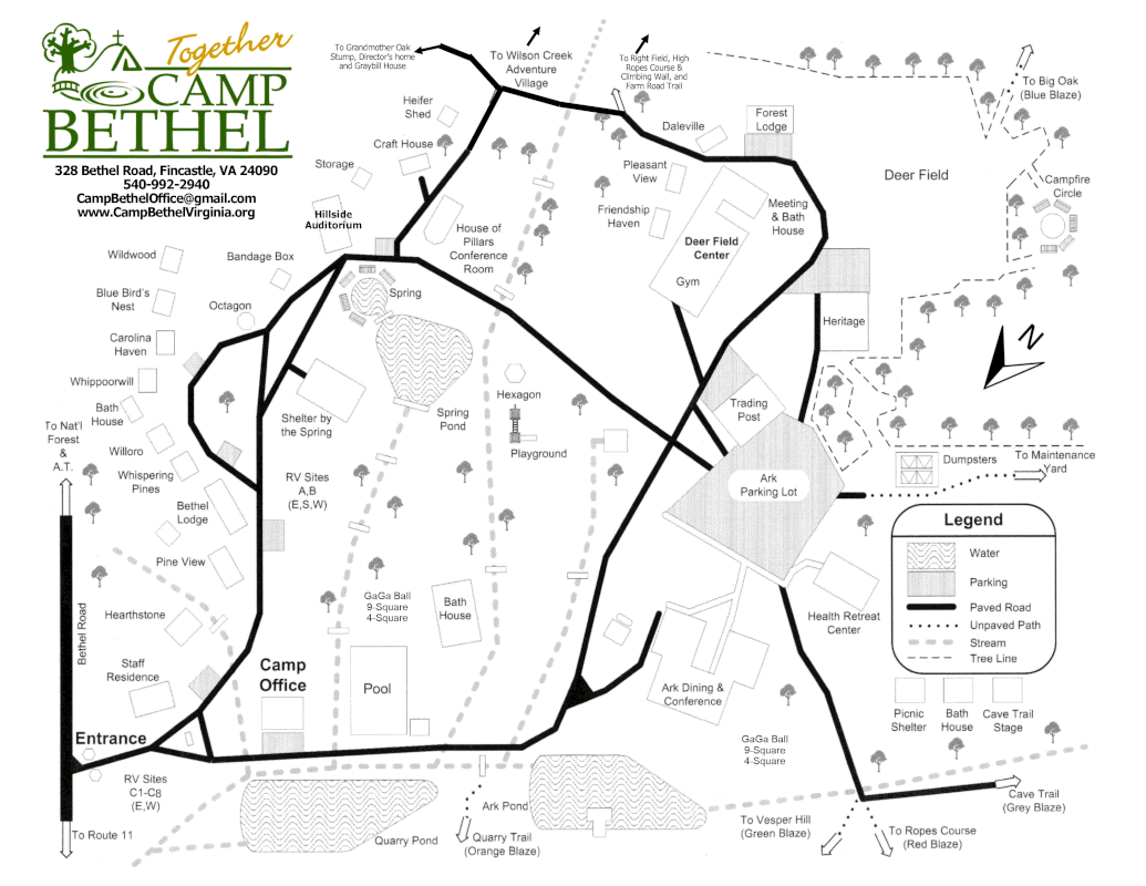
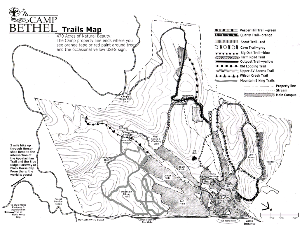
- A map of Camp Bethel. Downloadable here. There are also a limited number of maps on the porch of the camp office. We recommend a printed version of the map for your adventure.
- A GPS unit or smart phone with google maps (only for the GPS adventures)
- Hand sanitizer (these adventures are designed to be no touch adventures, but we recommend that you use hand sanitizer frequently)
Rules to follow while adventuring at Camp Bethel
- All clues or challenges are outdoors, there is no need to enter any facilities. At this time, we do not have restrooms available-plan to go prior to your arrival and pack accordingly for any emergencies you may have.
- You are looking for small metal plates on stakes that have different colored borders.
- Leave all clues where you find them so others can enjoy.
- Be mindful of the color code for YOUR adventure. There are many adventures at Camp and we want to keep you on track!
- Look before reaching into dark places. Camp Bethel is home to many wild creatures.
- Avoid going off trail. Most clues or challenges are on trails or common spaces. Help fight erosion by sticking to the paths.
- All of God’s creatures are special and important. Enjoy their habitat as an uninvited guest.
- Take only pictures, leave only footprints. Keep Camp Bethel special for the next person or group.
- Leave living things alone. Use only dead and downed items for challenges. (Dead standing trees are important to our ecosystem.)
- If you encounter another adventurer, be polite but give them space – we have a lot of acres to adventure in!
- Share your successes and adventures on social media and tag Camp Bethel! (#CampBethelVirginia)
- Consider making a donation so we can continue to offer self-guided activities for all. Donations can be made here.
|

